redefine the heart
of a conurbation
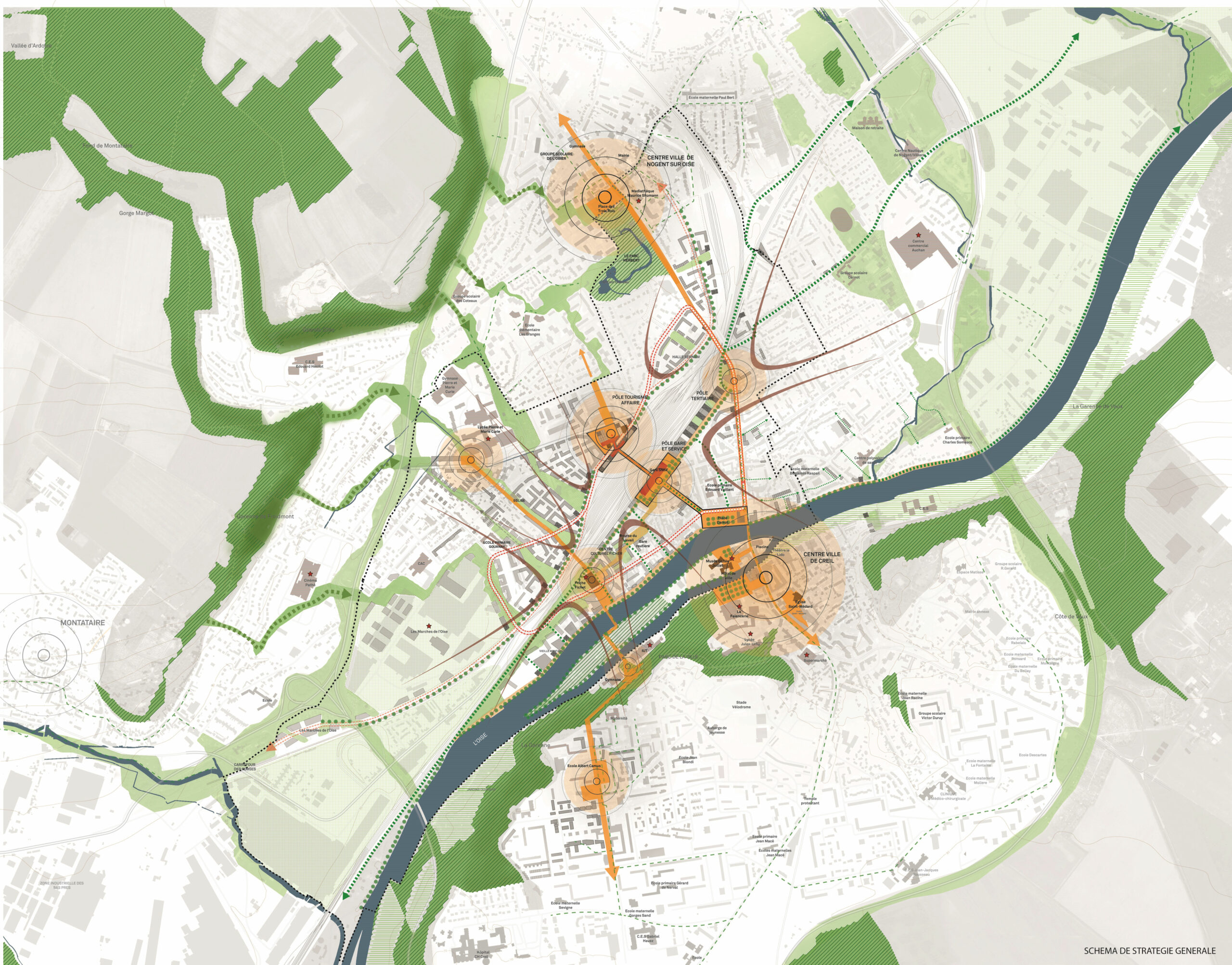
The redefinition of the central station district. is an ambitious project whose success depends on the innovative urban solutions that will be adopted. The site, which extends over 270 hectares, is remarkable for the diversity of its landscapes and its locations: wooded hillsides, banks of the Oise, warehouses, factories, workers’ houses. The people of Creill and of Nogent are deeply attached to these places, it is therefore essential to preserve their uniqueness.
This project, driven by a strong determination, by elected officials in particular, aims to orchestrate the renewal of the heart of the Creill area and the creation of jobs around the arrival of the LGV Roissy Picardie link in 2020. The central station district. has been formed over time by a mosaic of urban pieces, each having its own identity and operating logic. This singularity encourages to imagine tailor-made projects, adapted to each urban context.
ville paysage,
accessible and made-to-measure
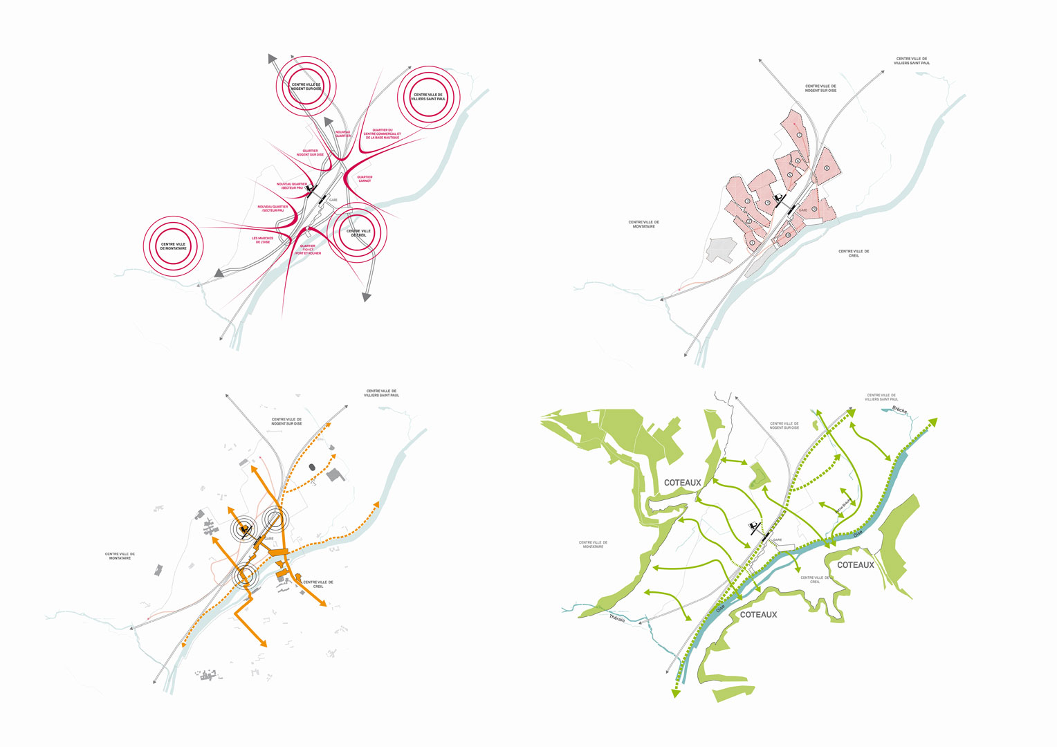
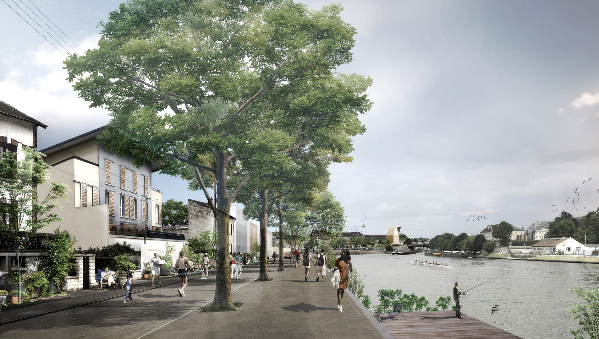
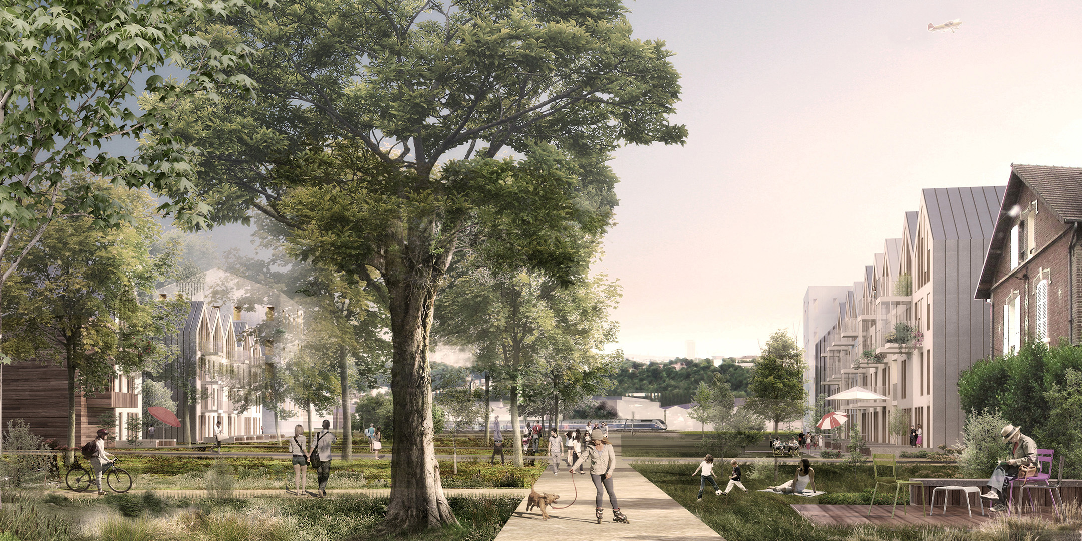
The “génie du lieu”(Genius loci), in the sense of the urban spirit, is the foundation on which the strategies will be based, whether it be the development of the hillsides, the reconquest of the banks of the Oise, or the opening of the blocks. The definition of an urban silhouette along the railways is essential. Respect for the architectural and social history of the Creill region will guarantee a specific identity for the agglomeration central station district. This is why “the heart of agglomeration spirit” is above all a desire to make the city differently: a landscape city, accessible, intense and tailor-made, able to offer an attractive living environment.
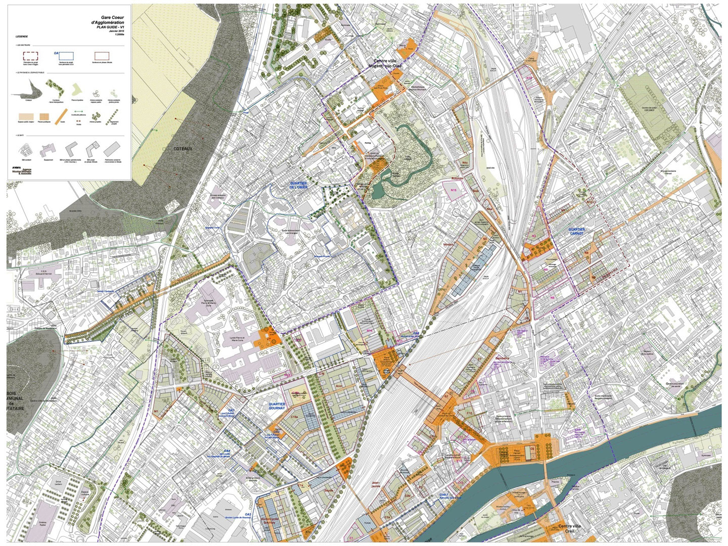
The guide plan defines “invariants”. They specify a general spirit, a direction towards which we must strive in the long term. The invariants are based on a series of positions: favoring renewable energies and bioclimatic design, “tailor-made” building, priority to the use …
invariants 1 & 2
Corridors
The installation of a green grid, the corridors, reveals the landscape of the hills bordering the valley. This green framework is accompanied by plant continuities open to pedestrians and bicycles, which gradually, will reconnect the city to the large open spaces on the plateaus while promoting a better connection of the city to its river.
Loop
The creation of a “loop” associating the different mobilities ensures the structuring of this new central piece of city which makes it possible to organize the different districts and the agglomeration entities. This road structure ensures better overall readability while allowing efficient trips from the fringes of the neighborhood.
invariants 3 & 4
Station
We propose to create a real urban station, in continuity with the city. A station that connects to major public spaces and spansover the railway tracks in the natural extension of historical public spaces.
Halls
The rehabilitation and integration into the new blocks of large industrial halls will integrate and bring together atypical programs (associative spaces, interior gardens, shared spaces) in connection with the residential districts.
PROJECT TEAM
PROJECT MANAGEMENT
Urban planner: ANMA
Transportation: Inddigo
Development economics: Expertise Urbaine
Programming: Polyprogramme
PRE-OPERATIONAL
Thomas Hermann
Nicolas Saugère
Jean-Remy Dostes
TECHNICAL SHEET
STATUS Research
PROJECT MANAGEMENT
Communauté d’Agglomération Creilloise
DELIVERY 2017
SURFACE 270 ha, 210 000 m² SHON
WORK VALUE 42 M€ HT
PERSPECTIVIST1 Plan
SEE +
Angers, Cours Saint-Laud
Dijon, Grand Est eco-district
Metz, Quartier de l’Amphithéâtre
